| Introduction | Activities | Projects | Resources | Services | Clientele | Contact-us |
| Projects Handled |
|
| IMPLEMENTATION | ||||
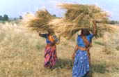
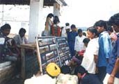
Watershed development & Rural development: Watershed programmes are being successfully carried out in several places. Rajiv Gandhi Watershed Mission, CAPART, CASA have confided in NCHSE by allocating these programmes. The programmes are implement with sufficient participation of people - they participate in planning activities as per their priorities and needs, also while implementing these, and after NCHSE withdraws from the area after project tenure is over, they maintain these activities as they are made that capable. End result: sustained & lasting effect of the programmes. NCHSE has built of several small check dams/ponds etc. under watershed development which serve purposes such as ground water recharge, nistar for local people, irrigation etc. |
|
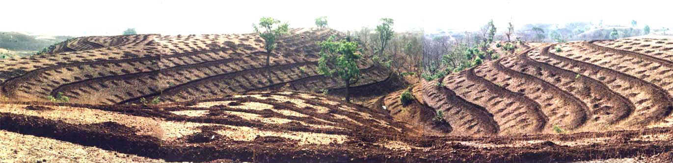
NCHSE has
also carried out numerous soil conservation activities to check soil erosion
& create vegetation. contour trenches, gully plugs, gabion structures etc.
are created on the hilly areas and slopes to arrest fertile top soil from
flowing away, recede water flow and other such phenomenon.
Pasture development is a help to villagers by way of fodder availability for cattle and, at places, many would generate income out of sales. Such efforts lead to less grazing pressure on forests also, so that regeneration is substantial. |
||
|
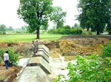
Dam Construction with Villagers' participation: NCHSE has made large contributions on the front of water conservation works. The adjoining
photograph is an example of one of such works, which depicts a dam constructed
at fairly reasonable cost, in record time, at Gailor village of Jhabua.
Ensuring peoples' participation this magnanimous structure was erected. The total cost was barely Rs 10.75
lacs. This has irrigation capacity of 75 Ha. area. |
|
|
||
Construction
of Maternity/Child care centre at
Jhabua
|
These
projects were assigned by Gas Authority of India Ltd. |
|||
|
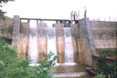
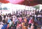
The Integrated
Watershed Development Programme, Multiple interventions were attempted which aimed at the natural resources rejuvenation and socio-economic improvement of people. The impact was highly favourable as it helped in Control of soil erosion; Substantial re-afforestation of 247 ha; Rehabilitation of degraded communal pastures, giving better yields and economic returns; Increased water supplies from water harvesting and raised groundwater levels;
|
|
|||
post-project scene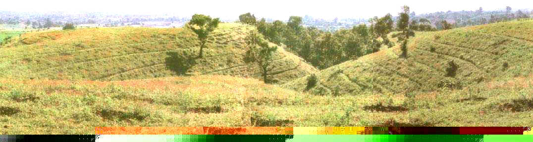
|
||||
|
|
||||
![]()
|
EVALUATION / MONITORING and DOCUMENTATION |
||||||||||||||||||||||
|
||||||||||||||||||||||
|
URBAN PLANNING |
| Perspective plan of urbanisation for Madhya Pradesh, 2021 The out come of project has appeared in form of documentation The report apart from discussing the status of the various requisite areas of urbanisation, describes at length the 11 geographical regions, 23 urban zones, and about 75 towns and cities which have the potential of urban growth, also identifies centers with potential growth for tourism, proposes new net work of communications like National and State level highways, new air routes, new rail links and industrial growth centres, which could, when implemented, transform one of the most backward states- Madhya Pradesh into one of most economically powerful states such as Maharashtra and Gujarat in near future. The report carries a massive and voluminous data of all aspects of urban development and should be useful to Research scholars, planners, economists, industrialists, Bureaucrats, local governments, and the common urban citizen, who is the most vital component of human society serviced by the machines of urban growth. |
The work is a very valuable reference document for all institutions and organizations engaged in training, planning research, implementation and administration of urban centers. |
|
|
![]()
|
TRAINING |
|
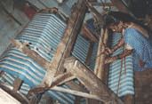
Skill upgradation A full-fledged Training Centre is developed by NCHSE at Kalyanpura, in Jhabua District & Saheli village in Hoshangabad District. The centre organises training programmes for the rural people - women, youths and poor, to impart various skills to help them earn their livelihood. Skill Upgradation work at Kesla Block of Hoshangabad District : Under this programme, trainings were first organised on handlooms and a forgotten trade was fully revived leading to self reliant handloom worksheds at various places in Kesla block of Hoshangabad Distt. M. P. several weavers are now whole time employed/self-employed and earn out of sales of their products at local Haats and commercial centres. |
|||
| Programmes are also organised by NCHSE, from time to time, at various locations to impart the necessary knowledge about Nursery Development. Women are also included in the trade. The programmes have been successful in creating an occupation and earnings to the people, as well as, these nurseries meet the requirement of plants/saplings at local level for plantation and afforestation programmes. |
|
|||
|
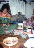
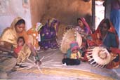
Gramodyog /Handicrafts Gramodyog is supported by way of training and Skill Upgradation Programmes for instance: Handlooms, handicraft, beadwork, basket making. The rural poor get a regular source of income as also old traditional art are so revived. The tribal beadworks are quite popular item. |
|||
| NCHSE has even constituted a small beadwork production cum marketing oriented unit in Jhabua for the purpose of support to tribal artisans. |
|
|||
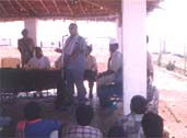
| Trainings
of Master Trainers of various PIAs (Project Implementing Agencies) have
been organised. Every month 30 trainees would participate. So far, 1000
persons have been trained on various aspects related to Watershed, components
of the programme, techniques of Soil & Water Conservation, Formation of
self help groups, Financial controls, etc.
|
We also conduct Training in PRA, Watershed Planning and Implementation, GIS, Cartography.
|
|
|
![]()
|
IT and ICT APPLICATIONS |
|
|
GIS Based Watershed Development Planning |
|
|
The Preparation of GIS application in Watershed development planning Introduction The project is sponsored by the Department of Electronics (DOE), Government of India, New Delhi. The project is funded under the scheme of DOE to promote usage of electronics in the rural areas through its Rural and Social Applications (R&SA) Division. The effort is unique of its kind as it emphasise application of such a modern science as Electronics is, to the most traditionally managed (and to an extent relatively much backward styled) development works in the rural areas. The project is part of the very concept as to apply computers for benefit of rural people through the implementing agencies working in the fields. The project emphasise development of cartographic database and its utilization for rural development processes (mainly -watershed). |
Following exercises have been carried out under the project: Preparation of data bases: Narrative and cartographic databases are prepared covering numerous themes and information items related to socio-economic and natural resources aspects. Sources have been: concerned Government departments, Survey of India toposheet & remote sensing products. Integration: Overlapping themes and producing integrated views by combination of selected themes. Scale alteration: Information transfer to maps from 1:50,000 scale maps to maps as large as 1:4000 scale (cadastral maps) has been achieved. Outputs and usage: Suggestions are made by technical experts and are pre-marked on maps. Ultimate outputs are made available on maps for direct use of villagers. Villagers express their agreement or disagreement for treatment and for site selection; and interaction goes on till mutual agreement. Action plan: Final action plans are formulated which are technically sound and socially acceptable. Thus, a fool-proof technical plan emerges which is agreeable to villagers: That is what is unique about the project. Documentation: Also, there is a documentation on whole procedure and methodology adopted, so that the step by step replication is possible for other sites/projects. Software: There is also a software called WATMAN designed to assist through the entire process functional on simple CAD platform. |
|
|
Main features: Preparation of database Formulation of Watershed action plans Sufficient weightage to technical aspects Sufficient weightage to requirements/demands of villagers/village Unique exercise of transferring information from one scale to another to bring it down to as large as 1:4000 scale of maps Preparation of standard METHODOLOGY for planning process Preparation of software to assist through the process for replication |
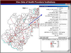
| GIS Based Health Information Management System | ||
| DANIDA
sponsored a project on GIS Based Health
Information Management Systems for the Madhya
Pradesh Government Public Health and Family Welfare Department.
A Package on GIS was prepared in-house by NCHSE, which has been commissioned for use at all block medical offices. |
 |
|
| GIS Based Village Information Management System | ||
|
GIS Based Village Information Management Systems for the Madhya Pradesh has been developed. This gives for all the districts of Madhya Pradesh, the village index map (Mazmoolis). The maps associate the demographic data 2001. A useful tool for planning activities, identifying villages, comes in a user friendly form. It works on MapInfo. Govt. Departments and NGOs make use of the system for planning, monitoring activities. Ask for a demo copy! |
||
|
Software Products: |
||
|
Software procedure for Watershed Planning: A detailed procedure is prepared. It includes a base map will be generated and integrated. It is a multimedia supported procedure which allows to interact with village in most communication effective manner. |
Software Package has also been produced for Networking of Villages called as "SOOTRA-DHAR" and has produced it for Jhabua DRDA. It links district
HQ with Panchayats, for information exchange. |
|
| Rural ICT Applications: | ||
| SAMADHAN
KENDRA Sponsor: Ministry of Information Technology, Govt. of India |
This is one of the only 4 pilot projects in the country. |
|
| GYAN
SANCHAR KENDRAs Sponsor: CIDA-BSNL |
First ever model assuring
sustainability. Network for all the districts of Madhya Pradesh. Entrepreneurs may join the network - "earn and serve". |
|
| ISRO-NCHSE
VRC (Village Resource Centre) Network Sponsor: Indian Space Research Organization (ISRO), Department of Space. Govt. of India.
|
First effort of NCHSE and ISRO. A
network of 12 VRCs.dedicated to Tele-Health, Tele-Education, etc.
This is based on original concept given by the exPresident of India
Dr.Abdul Kalam. |
|
|
|
![]()